Three days to Yuma
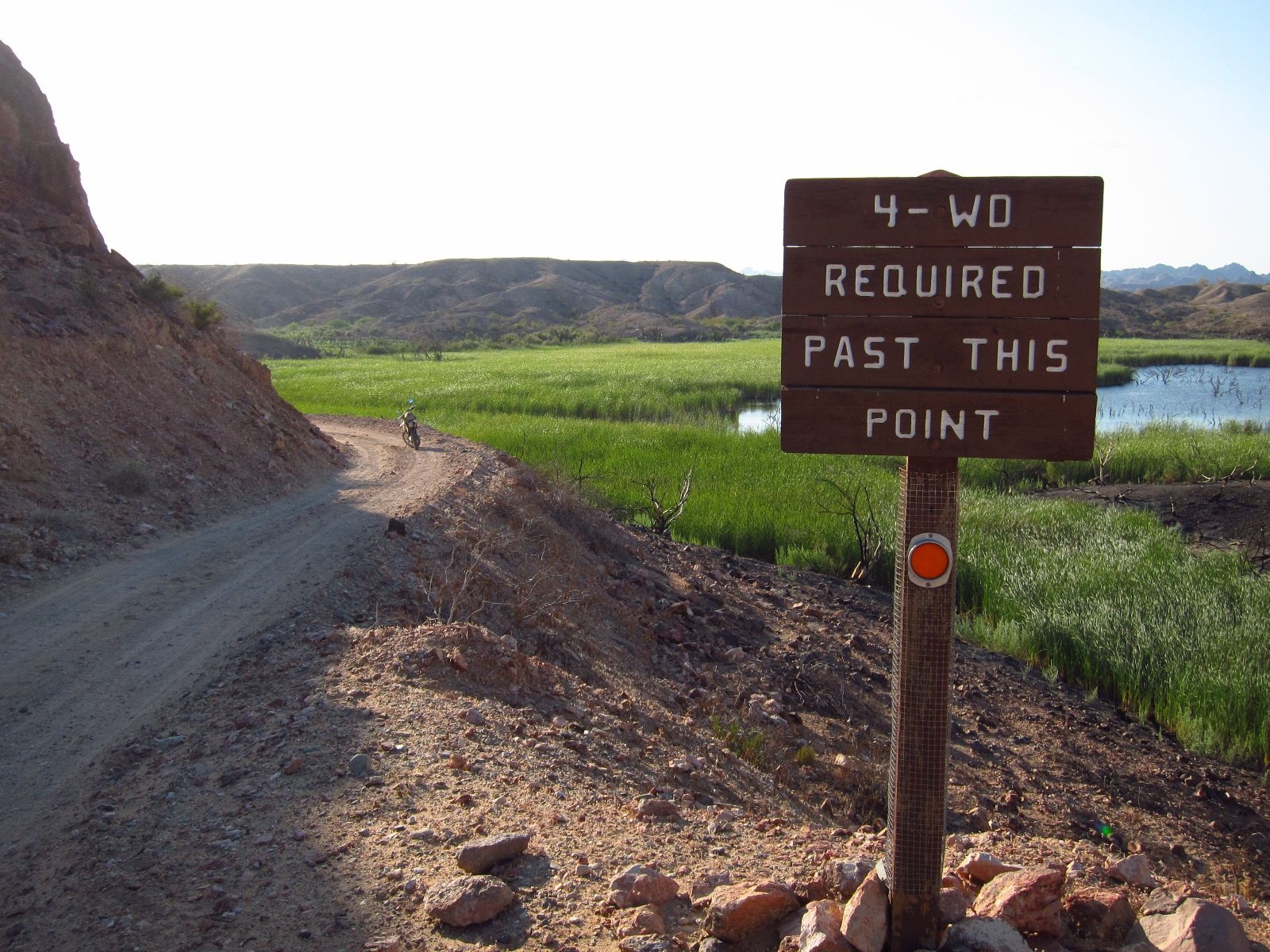
In hindsight, Indian Pass Road was probably a bad idea. It began to occur to me after five to seven miles in foot deep, loose gravel on the bottom on a dry riverbed. It really hit home, when I found myself at a crossroads. There was no sign to lead me either way, and my map showed no intersection. I had the choice between following the riverbed to the right, or breaking off to the left up a fairly steep cliff, where some vehicles had driven, yes, but which hardly qualified as a road. I followed my first hunch and went right. After a few minutes, the road turned sharply to the right and I had to brake hard when the trail ended in a bunch of rocks. They would undoubtedly make for an exciting rafting trip during a flash flood, but were significantly more gnarly than anything I would navigate Pidge through. The sun was setting, but the temperature was still in the nineties, and even though I had brought a sleeping bag, bivouac, and some rations, I did not feel like sleeping involuntarily in the wilderness.
Ocotillo Wells
Due to Memorial Day, I had a long weekend. That was to be spent in Pidge’s good company in Southern California. I had explored parts of the area before, but never been to Yuma. Since I like the western 3:10 to Yuma, that was as good a destination as any. Of course it also suited me well that there should be plenty of opportunities for off-roading on my way there.
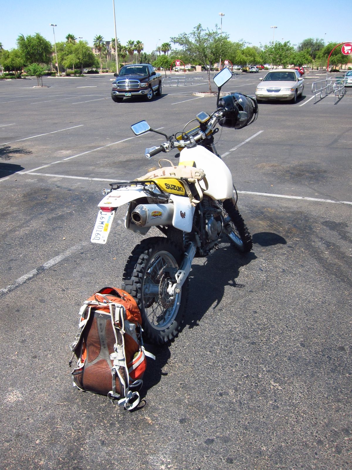
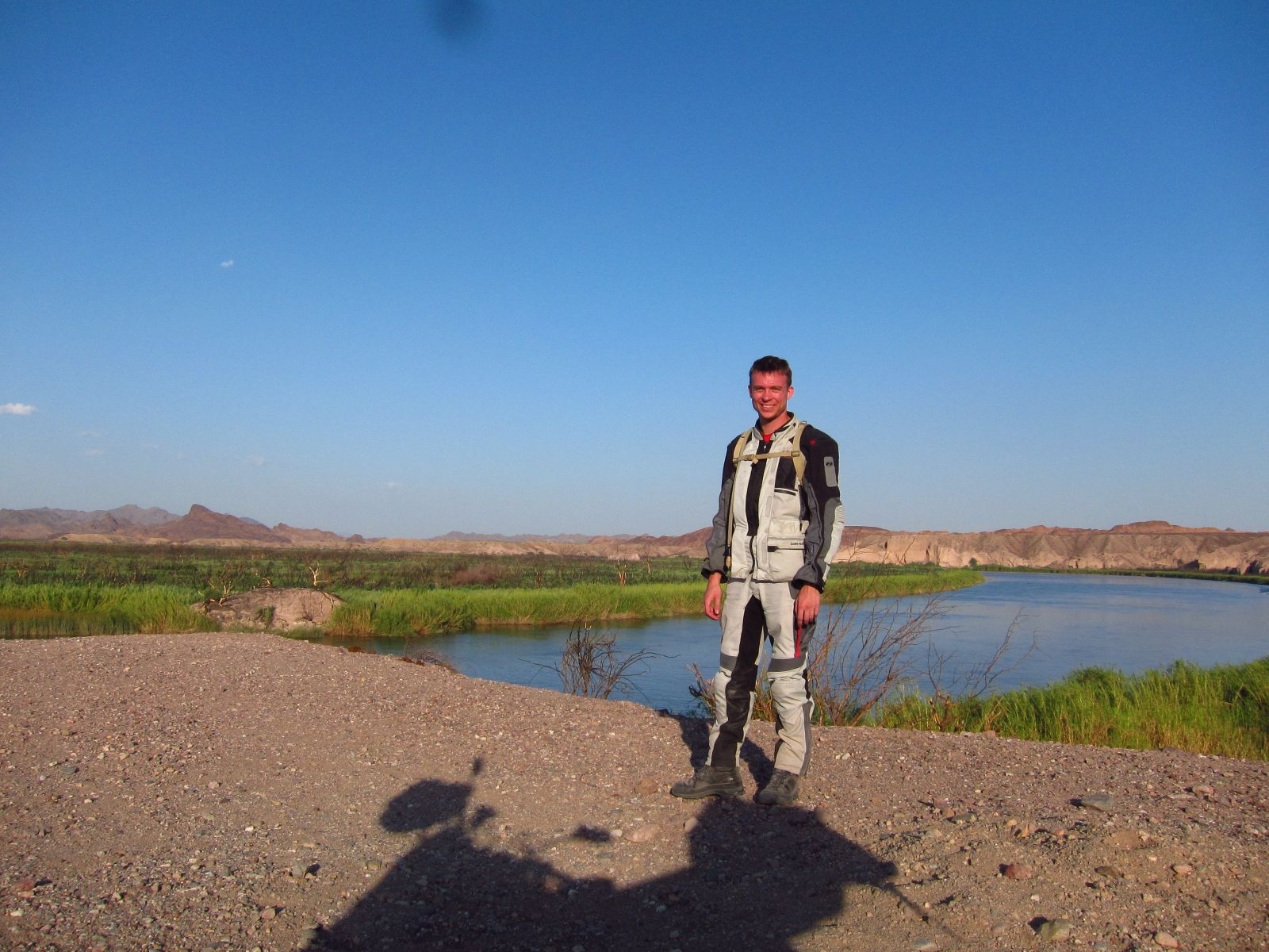
It was my first trip on Pidge over several days – in fact, my first ever motorcycling trip spanning multiple days. I allowed myself plenty of time to pack Saturday morning and hit the road around 10:30. The plan was to camp north of Yuma the first night, and then se what I could come up with after that. I set the course east, through Ramona and Julian. My first destination was Ocotillo Wells,an off-roading area in the Anza-Borrego desert. I’d been there before, but it’s an enormous area with lots of trails to do. The weather forecast promised cool weather. That seemed too good to be true, and it was. When I arrived, the heat was mounting and was already in the low nineties.
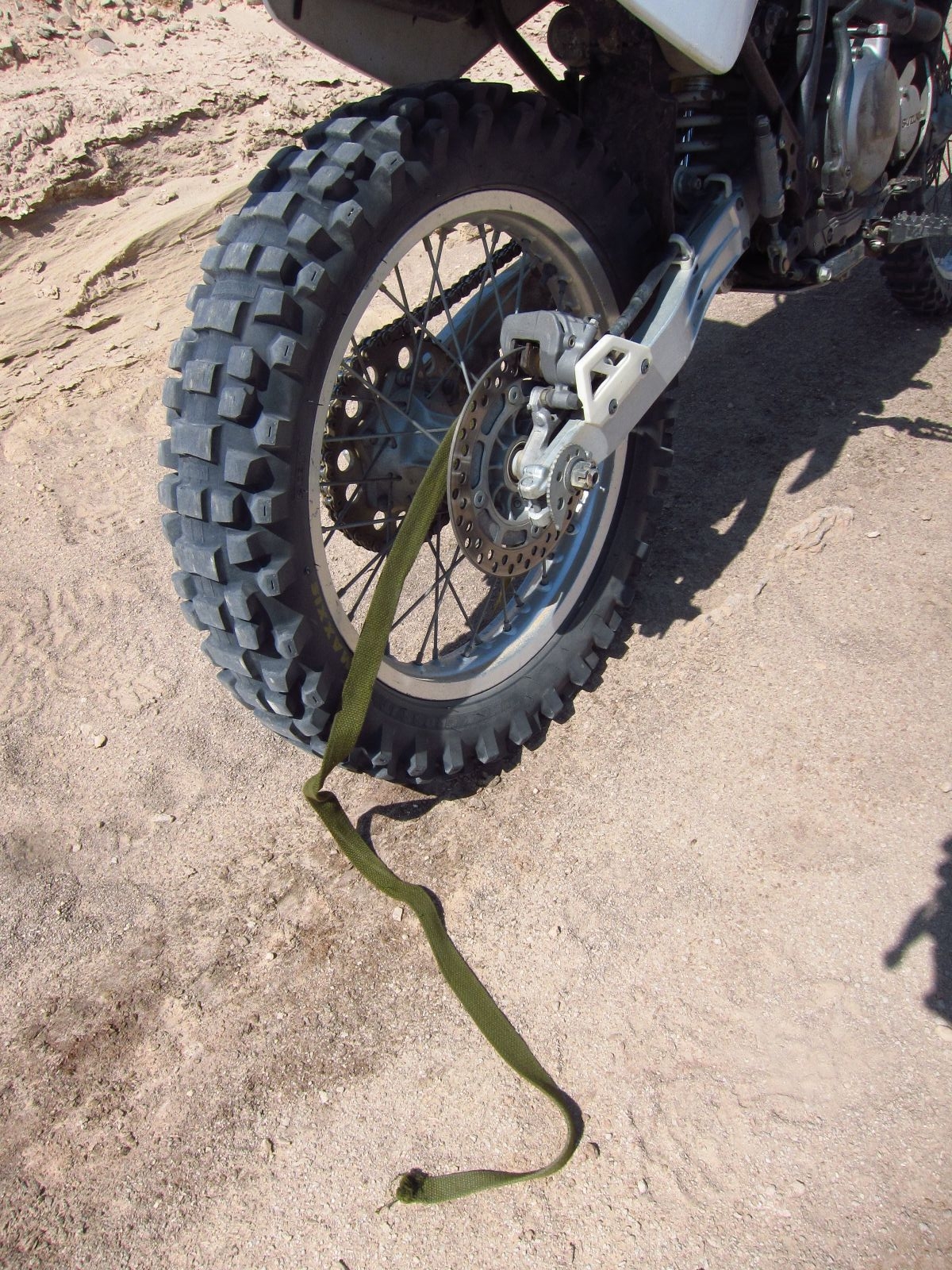
After an otherwise minor spill in a dune, one end of one of my luggage straps was caught in the wheel – as I discovered a couple of miles later.
I did a few small loops and had my sack lunch, before I decided to cross the entire area to Salton City for fuel. Let’s just say it was a good challenge. Or at least a challenge. Back when I was in Iraq, I got a lot of experience with offroading, but only in four wheeled vehicles (and on tracks, but that’s almost cheating), and there are 3 rules: 1) Pick a line and stick to it, 2) keep on the gas to keep momentum, and 3) I told you, keep on the gas! I’ve learned that the same in the case for motorcycles. Here you just have to react even faster. But I made it through after a handful of pretty uneventful spills. Maybe except for the one where I was going up a hill, which turned out to be a little too steep, on an trail of fist to skull sized rocks. Pidge decided to ride on the rear wheel only, as I was about halfway to the top. I managed to keep the balance on one wheel for the next 15-20 feet, after which I had to bail and let Pidge do as she pleased. Fortunately she laid herself nicely on the side at the top of the hill, and I could ride down the other side after a few deep breaths.
I refueled and bought a couple of cold Gatorades in Salton City, and had a nice break. Then I headed to Yuma, where I arrived too late to camp and instead checked in at the local Motel 6.
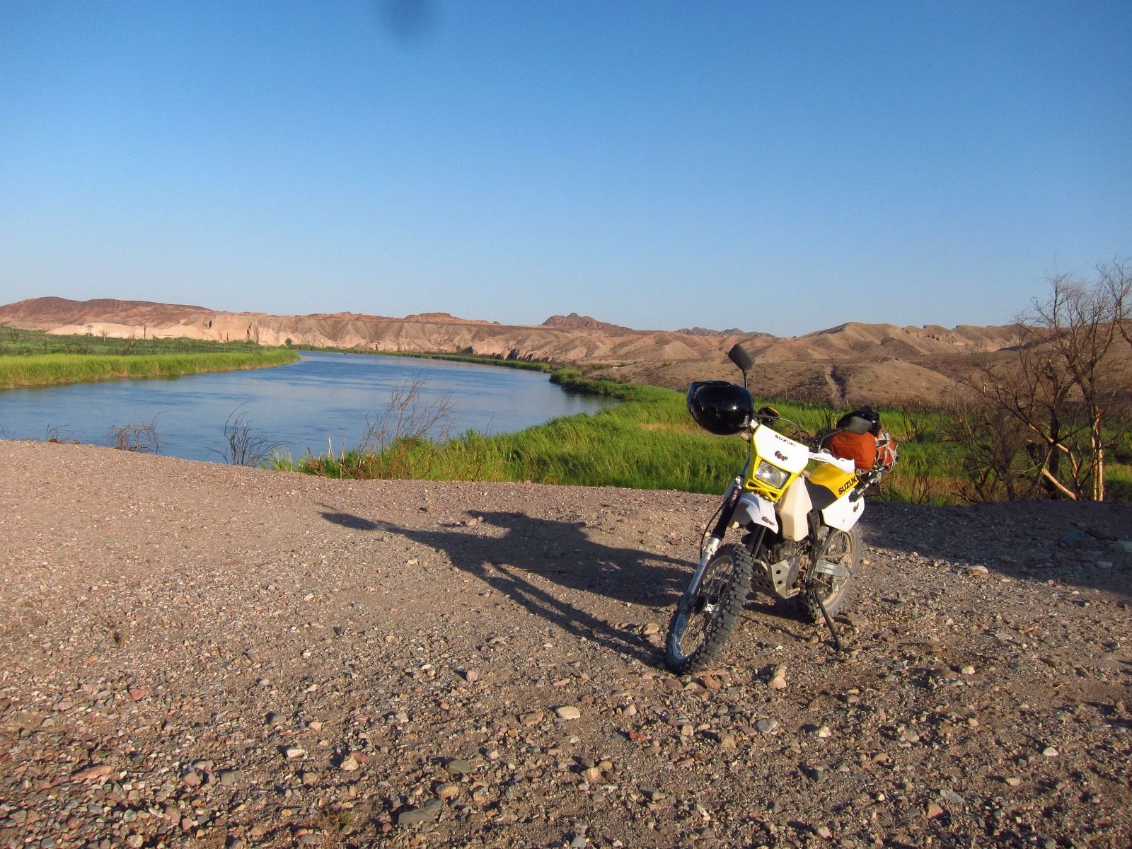
Yuma is a city defined by trains, the Colorado river, and its rich Western history. Back in the day, Yuma was the easiest place to cross the Colorado river, so most pioneers going west went through. Since then, the city seems to be just a shell of its former success. Many dams and bridges have been built over the river, so people can cross elsewhere. What’s left are the trains – in fact, the river is so heavily diverted for irrigation, that only a trickle is there when it enters Mexico. This year, for the first time in 16 years, the river was allowed to run all the way to its natural end in the Pacific.
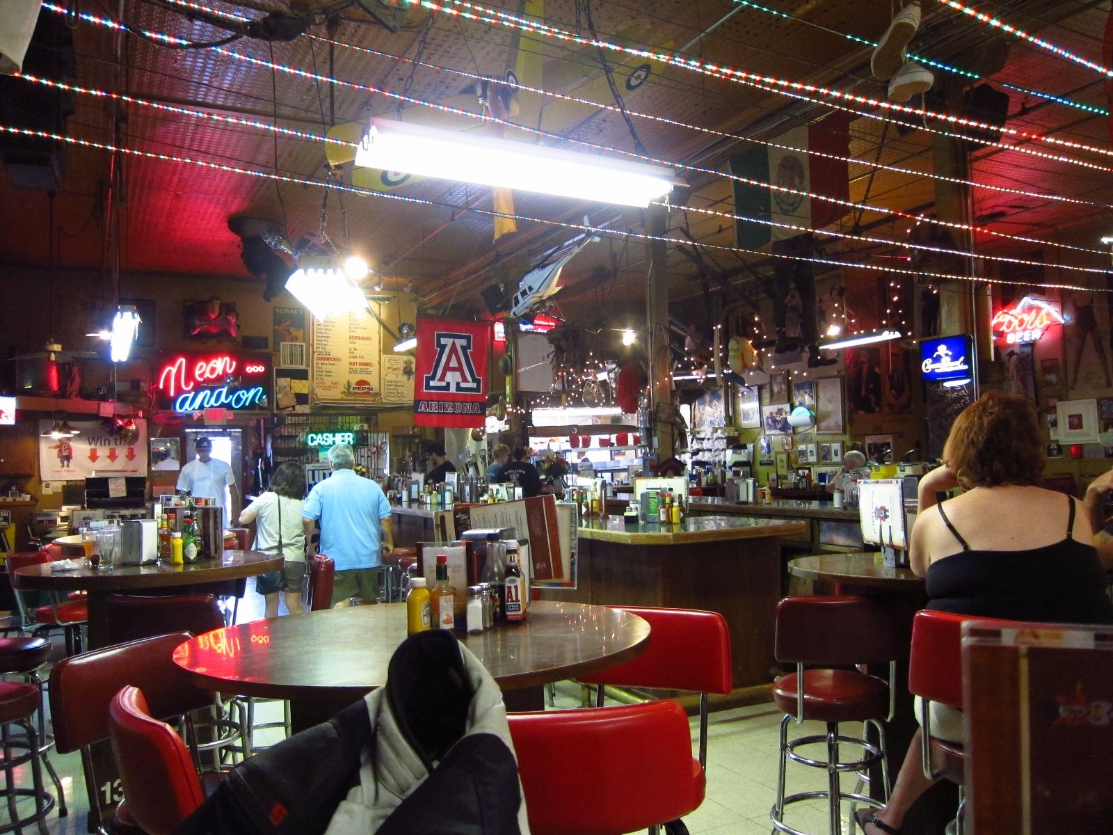
Yuma is certainly not a typical tourist destination, but I found its dusty and rusty industrial looks oddly fascinating. I visited their “Historic Downtown,” which was supposed to be the center of the city, but was completely dead. Some of the hotels and stores have given up completely, the travel agency is closed for the season, and the most successful business seems to be the copy machine store. Okay, to be fair, I ate a bad burger at Lutes Casino – which is not a casino – and that place was pretty full.
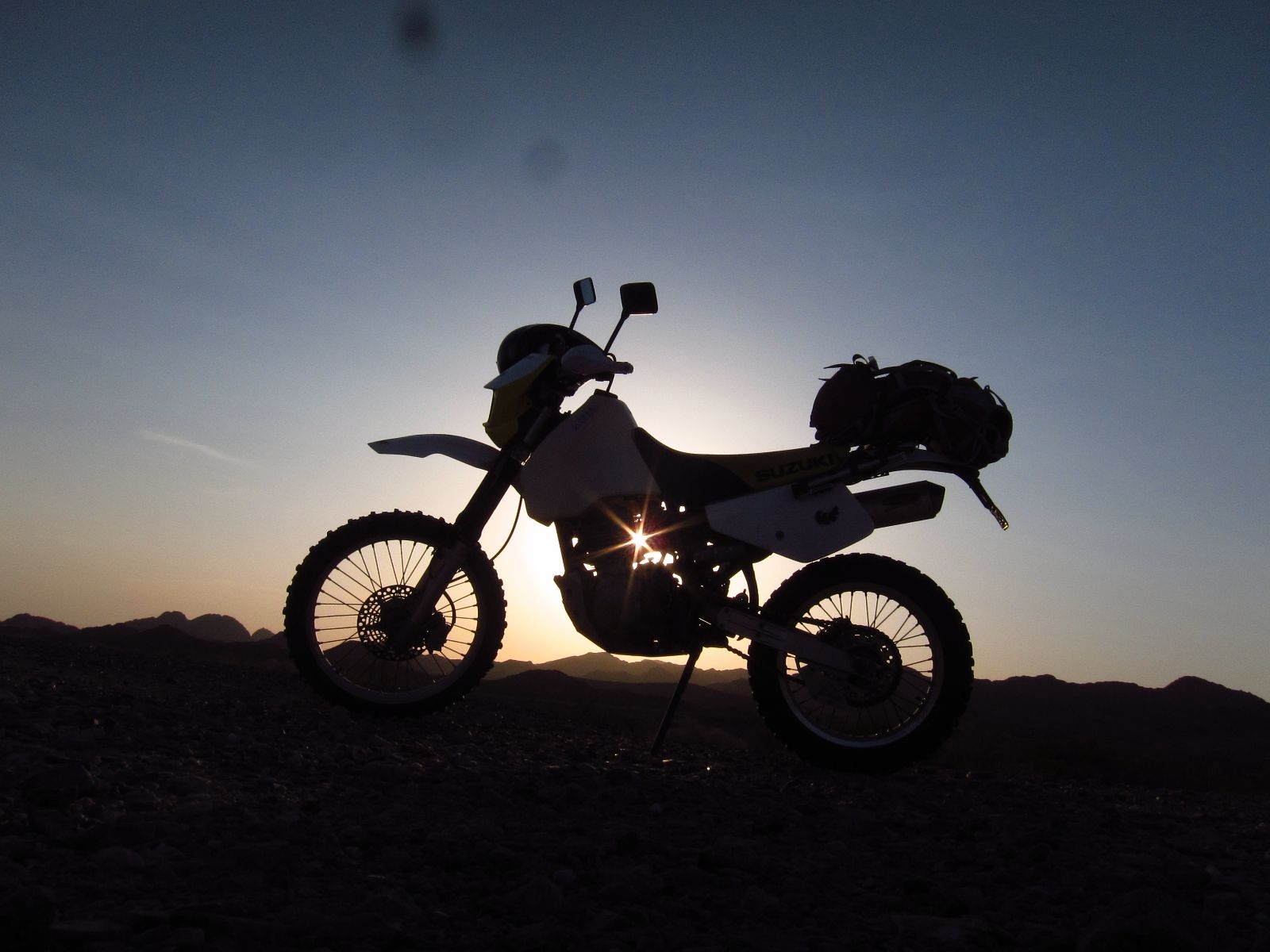
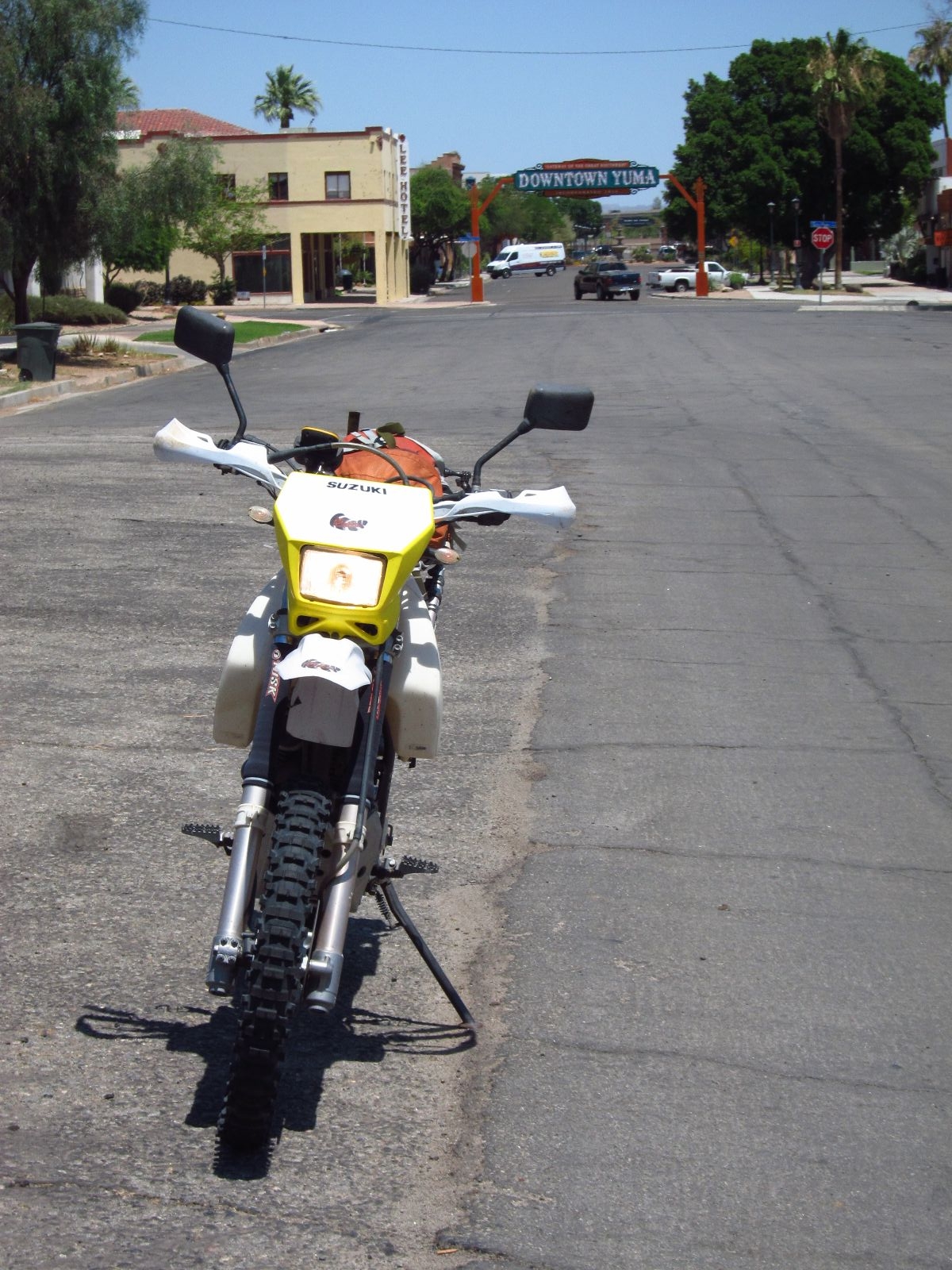
Ready to go, day 2.

Yuma Main Street
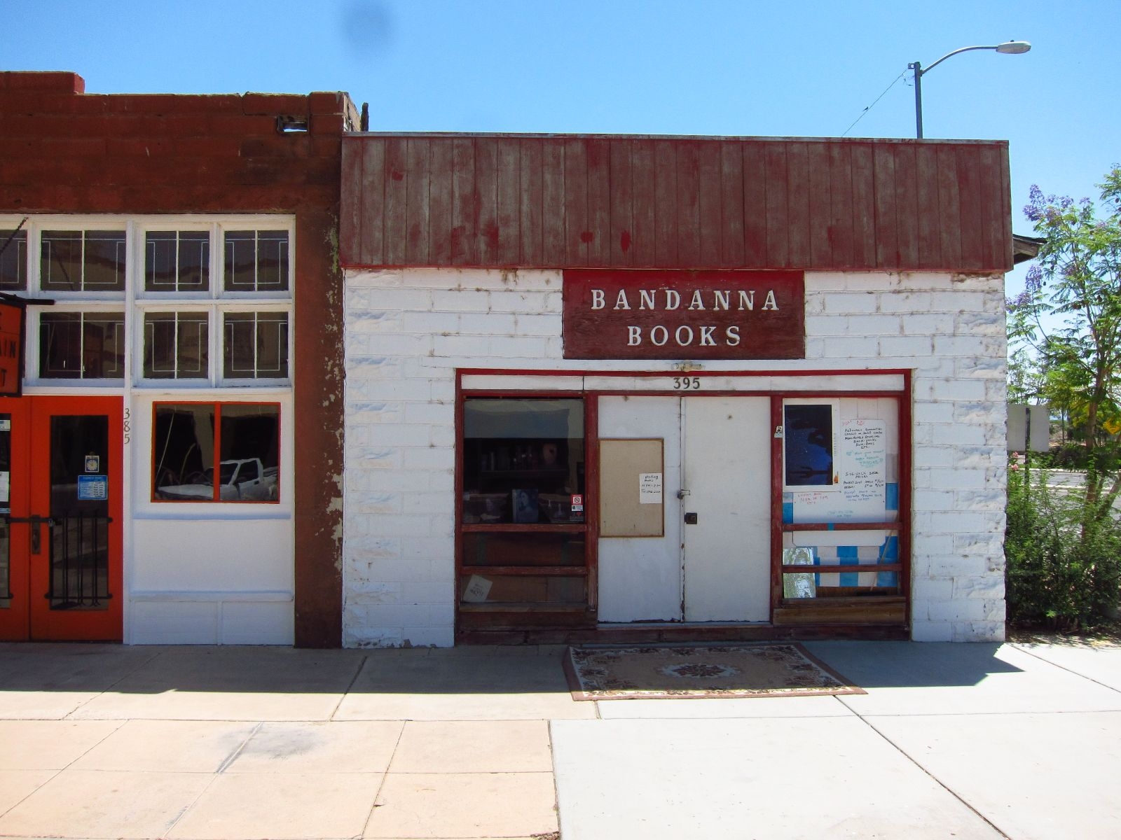
Yuma Main Street
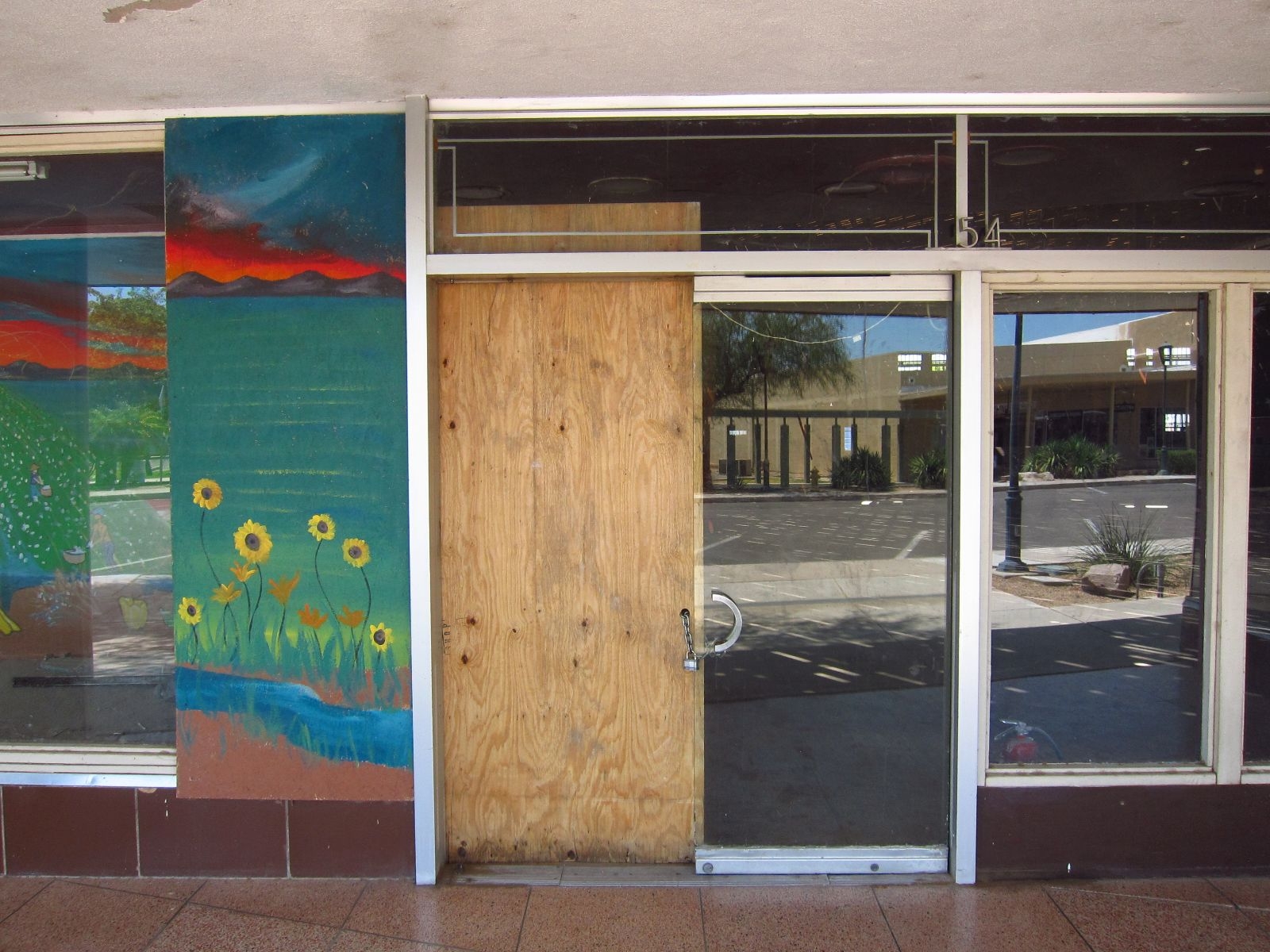
Yuma Main Street

Perhaps Yuma Main Street’s most successful business…
Lutes Casino
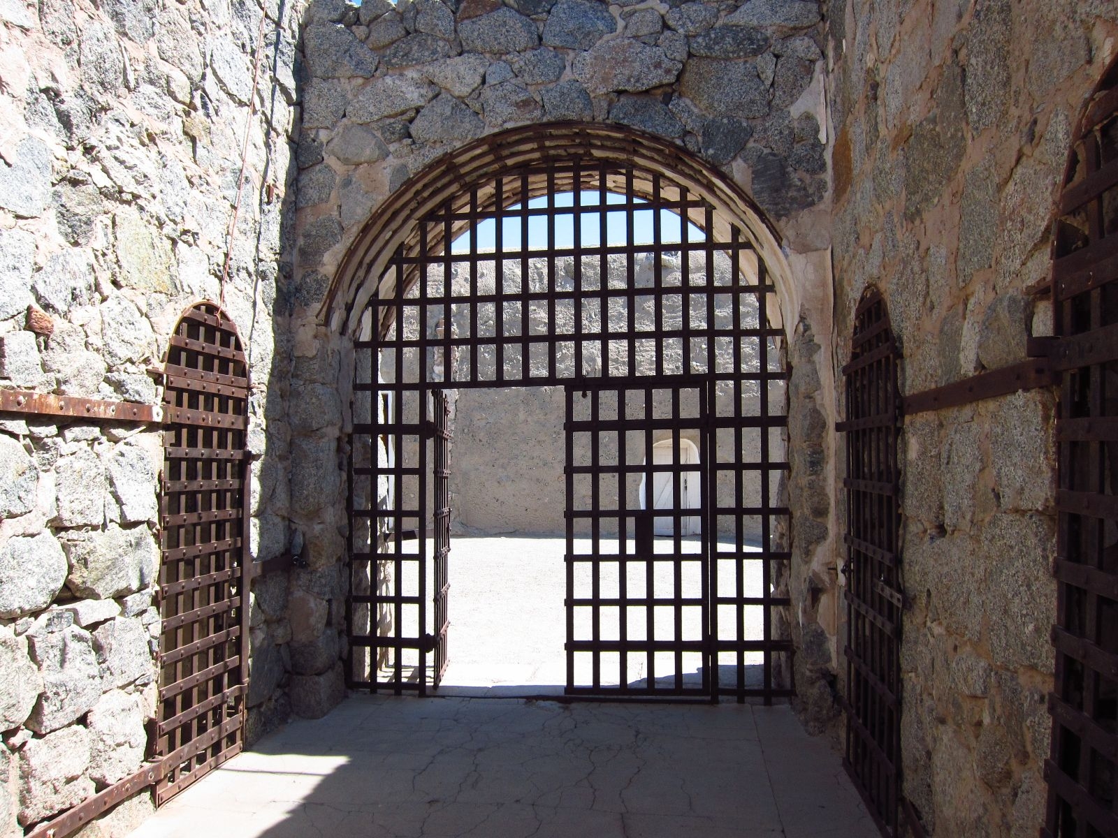
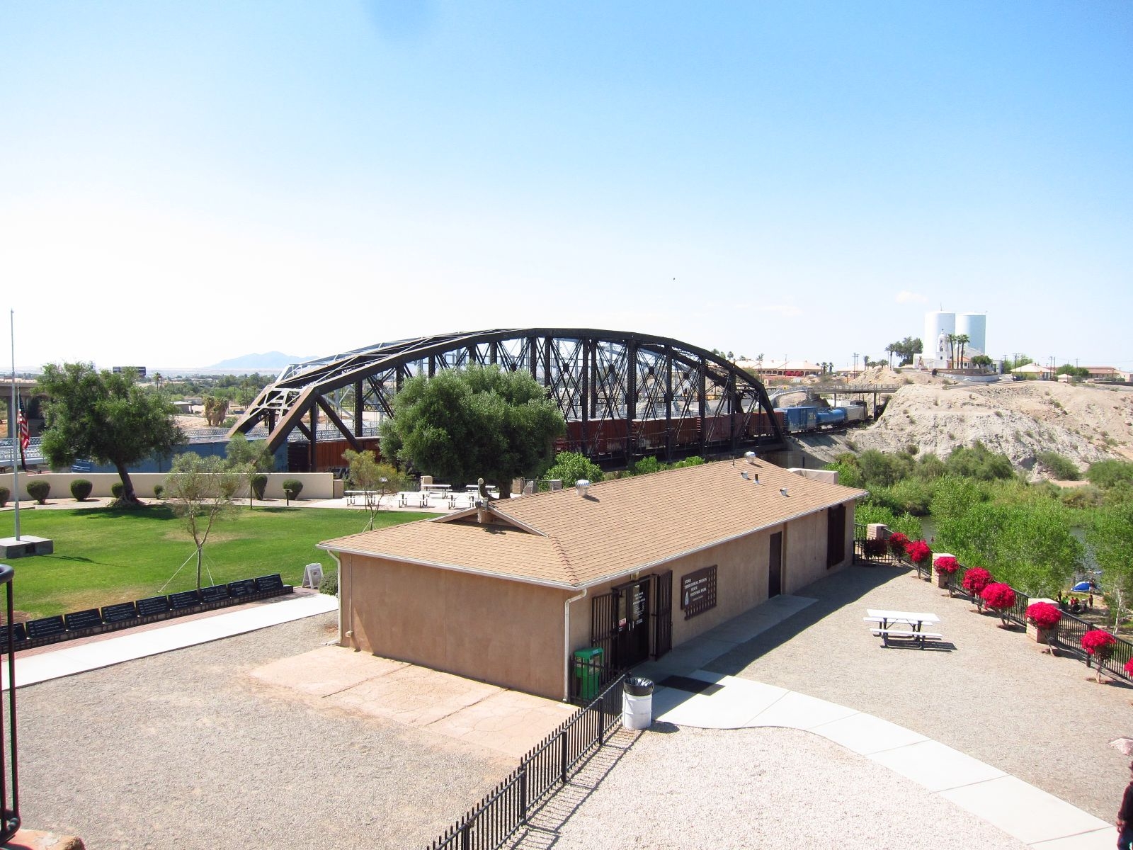
3:10 to Yuma takes its name from a train departure the bad guy has to be put on, so he can get to jail. Naturally, I had to visit the legendary prison, and it was very interesting. There is only parts of it left, since some of it was torn down to build a railroad, in times before people realized it might be interesting to keep such places for historical purposes. The museum it very well done and I spent a couple hours reading about the some of the 3000 people who had the bad fortune of being inmates in the 33 years the prison was active from 1875 on. Yuma’s status as railroad hub means that many hobos come there by freight train, so after the prison closed, some of them started inhabiting the cells. The prison also housed Yuma High School from 1910-1914. Even today, the high school football team is called Yuma Criminals.
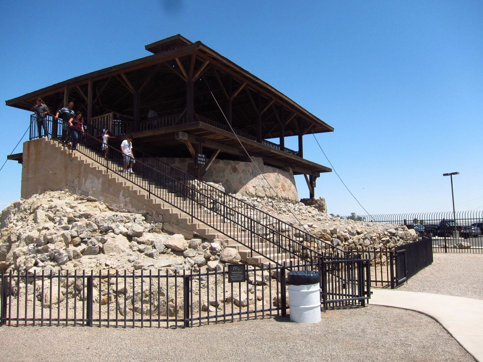
The main guard tower in Yuma Prison. Built on top of the prison’s water reservoir.
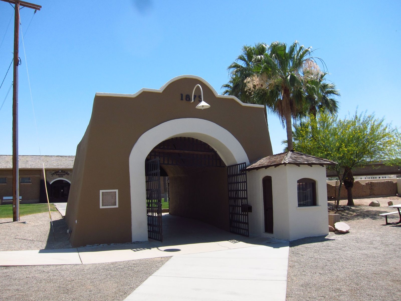
Yuma Prison main gate.
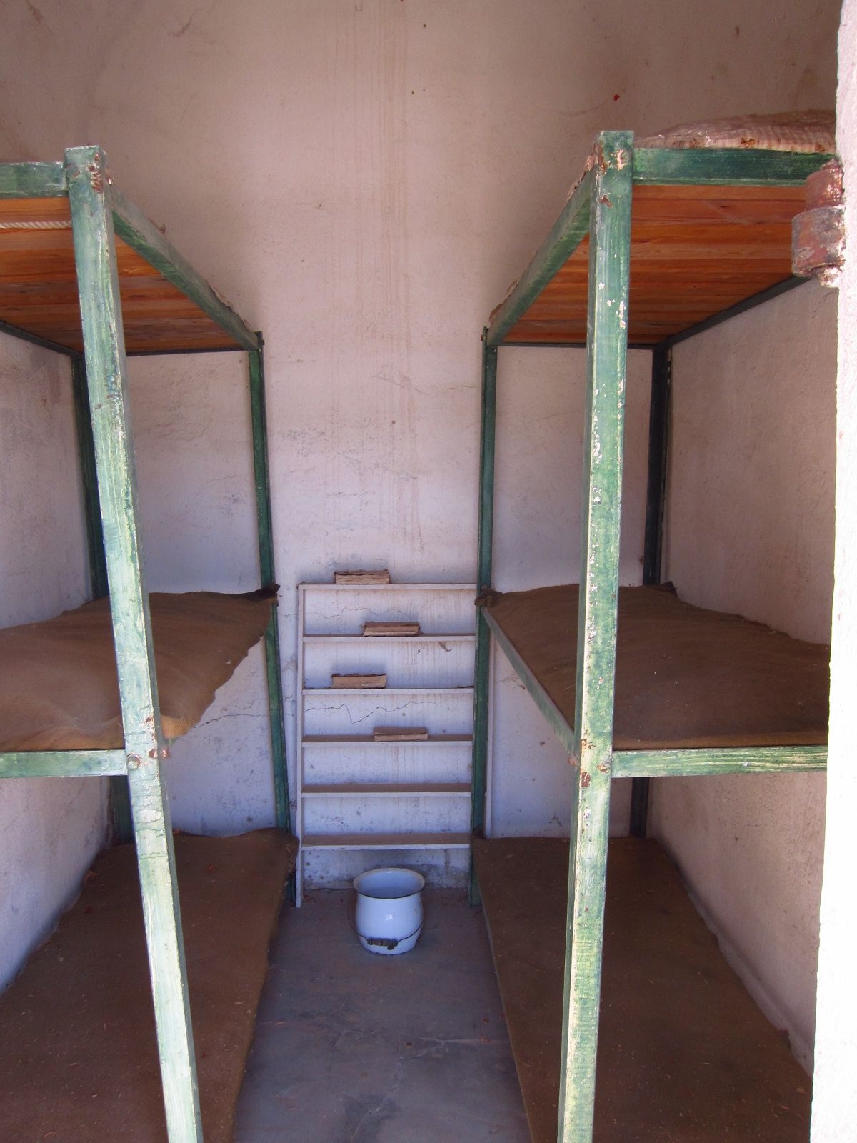
A six man cell.

On of the many freight trains. This one had 124 carriages, and was thus nearly a mile and a half long.
Those who have had the fortune of traveling Southwestern US with me will know that I regularly exclamate that “except from X, this place is exactly like the Iraqi desert!” but never have I been to a place that reminded me as much of Basrah as Yuma did. Situated in the middle of an inhospitable stone desert, but with a river that breathes life into nearby plantations and farmland. Even the moist smell, which lays as a thick, humid blanket over the area is the same. I have to say, though, there is less trash in the streets, the houses are built of wood rather than clay, and the amount of armored vehicles in the streets is much lower.

Less that five minutes of walking from Yuma Historical Down Town.
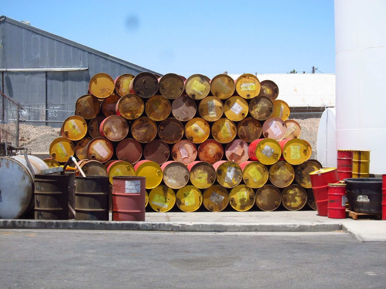
Yuma has a very industrial ambiance – but many nice photo opportunities none the less.

Going out of Yuma, I passed by the proud town of Felicity. It has two inhabitants and is officially the center of the world. At least as far as the authority of Imperial County Board of Supervisors can reach. Felicity was founded by French-American Jacques-André Istel, who had money and needed a hobby after he sold his parachuting school. The other inhabitant of the city is his wife. In the Southern end of town is a 21 foot high pyramid, which accurately designate the center of the Earth. But that is just the beginning of the bizarre concoction that is Felicity. When Jacques-André had established his status as the center of the Earth in 1985, he embarked on the second half of his project: documenting the history of the world and engraving it i black granite. He put up hundreds of yards of polished granite – the engineers were told to design the foundations to last for 4000 years – in an intricate pattern, and began to write and illustrate his own version of the world’s history. His writings are then set in stone by an engraver he has hired. There are long rows for California’s and Arizona’s history. That seems logical. But he also has an even longer row dedicated to something as specific as French aeronautics history. He’s not yet done, but every year the 85 year old eccentric adds a little bit more.

Right in front of the center of the world.
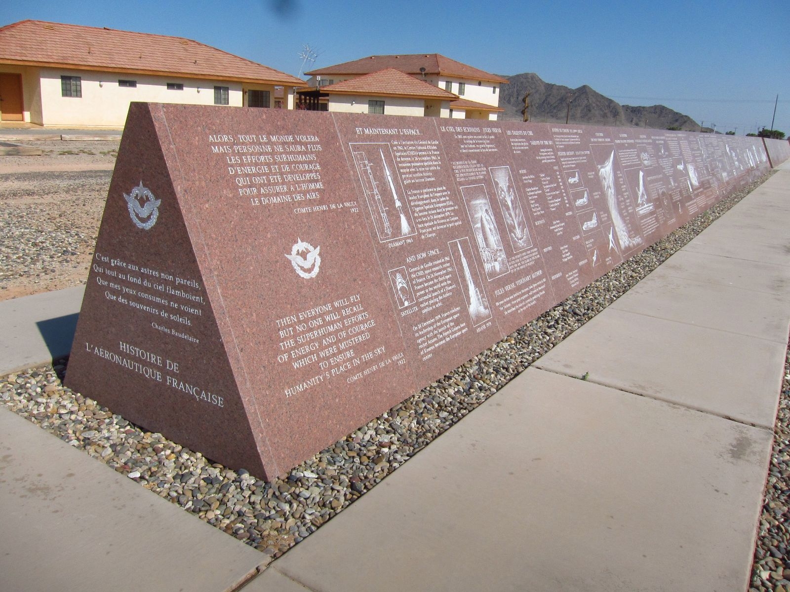
French aviation history.

The end.
At the end of it all, he has built a large, artificial hill, on which he has erected a chapel. He is not religious, so he can’t really explain why he built a church, but he has. It is all very weird and fascinating. My description does not do the place justice. Earlier this year, The New York Times had an interesting article about the place, but really, it has to be experienced.

Museum of the History of the World in Granite.
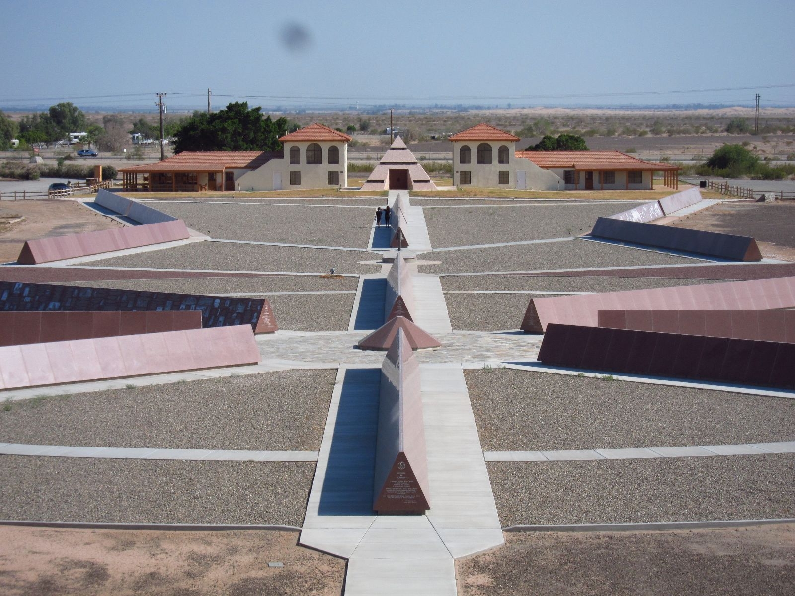
The center of the Earth in the pyramid in the distance.
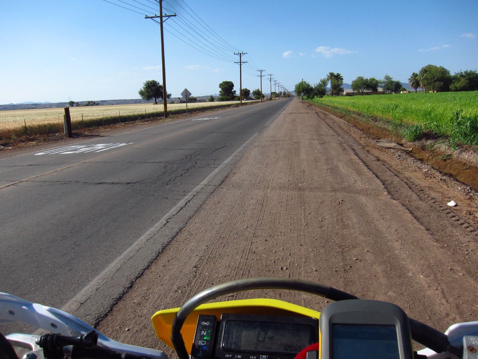
After contemplating eternity among the granite stone, I kickstarted Pidge and headed north. Most of the day had passed already, and it was about time to get some miles done. I hoped to make it to Anza-Borrego to camp, but before that I wanted to check out Picacho State Recreation Area, where I had originally planned to camp the day before. It was not a big detour and would give me a nice, long stretch of gravel roads instead of boring tarmac. I had expected just a little activity in the park, but going there I only met a single car, and after that not a soul for several hours. I put my 5 dollar fee in the mailbox at the entrance and followed the river for a while before I found Indian Pass Road.

Approaching Picacho State Park.
Calling Indian Pass Road a road is similar to calling Russia a democracy. It might technically be true, but as soon as you look closer, you’ll be disappointed. And thus it was, that I found myself with my rear wheel sunk 8 inches into the sand on the bottom of a riverbed. Despite it being close to sunset, the sweat trickled down my back after the physical and mental challenge during the past hour. I studied my GPS for a while, looked at the rocks in front of me, and laboriously turned Pidge around in the narrow canyon. Back to the cliffs where the road had split. Two deep breaths, and I ventured up the hill. It was not as bad as it had looked from the bottom, but it was not exactly Interstate 5 either.
Close to the beginning of Indian Pass Road.
At the top I crossed through a pass – which I later realized must have been Indian Pass – and found an information sign with maps and brochures. They had been there for years and were so faded that I was basically just looking at white paper. My initial excitement over figuring out exactly where I was faded just like the maps, but at least I knew I was not completely outside of civilization. I carried on, and before long I hit a nicely graded gravel road. After a while it intersected Ogilby Road, just as planned, and I took a break.
The sun was almost at the horizon and I realized it would be impossible to get to Anza-Borrego in time to camp that night. Instead I aimed for Brawley. It took me about an hour and I enjoyed the sunset while cruising through Imperial Dunes. The temperature fell comfortably, as I hit the heavily irrigated Imperial Valley. Inside my helmet, I sang along to Wonderwall on my iPod. I found a motel, three beers, and a sandwich and collapsed on the bed. Good day. Next time I’ll make sure to give someone my itinerary before I go offroading where people are not passing by regularly. Unfortunately, I have no pictures from Indian Pass Road, as my camera ran out of power. A back-up battery has been ordered, so that won’t happen again.
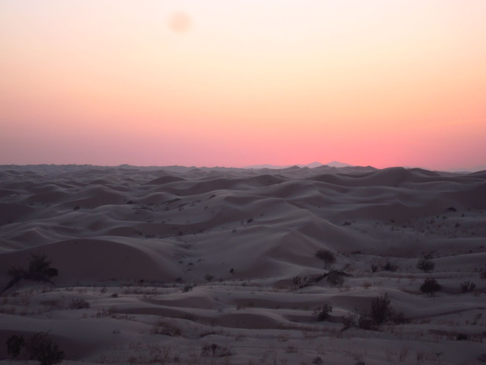
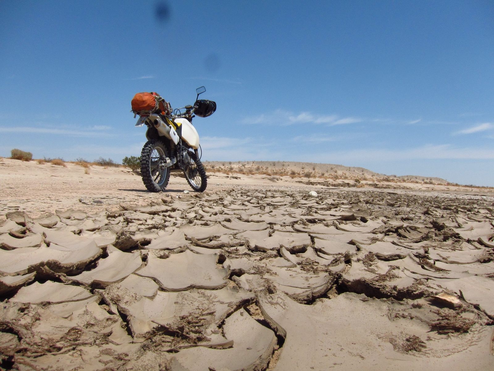
Imperial Dunes
I did not feel like I was running on all cylinders Monday morning (me, not Pidge, she has only one and that ran perfect), so I took the direct route towards San Diego. After a couple of hours I needed a break and took the small detour to Lake Henshaw, which is beautifully situated among rolling hills in an almost Irish landscape. After half an hour and some trail mix, I felt much better and I decided end the trip by going up and down Palomar Mountain. James, a motorcycling math post-doc I know, had praised it highly, and he was right. That is the most fun piece of tarmac I have ever encountered. Going up, I had the road to myself, as I snaked through hundreds of sharp corners. The speed was rarely above 45 mph, but I felt like a racer. That was a great ending of the trip, and I rolled back to La Jolla with Guns’n’Roses in my ears and a huge grin on my face.
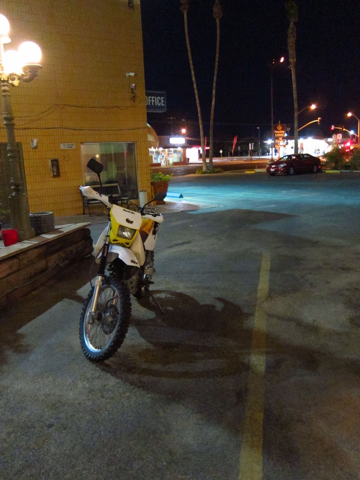
Pidge parked for the night outside my motel in Brawley.